
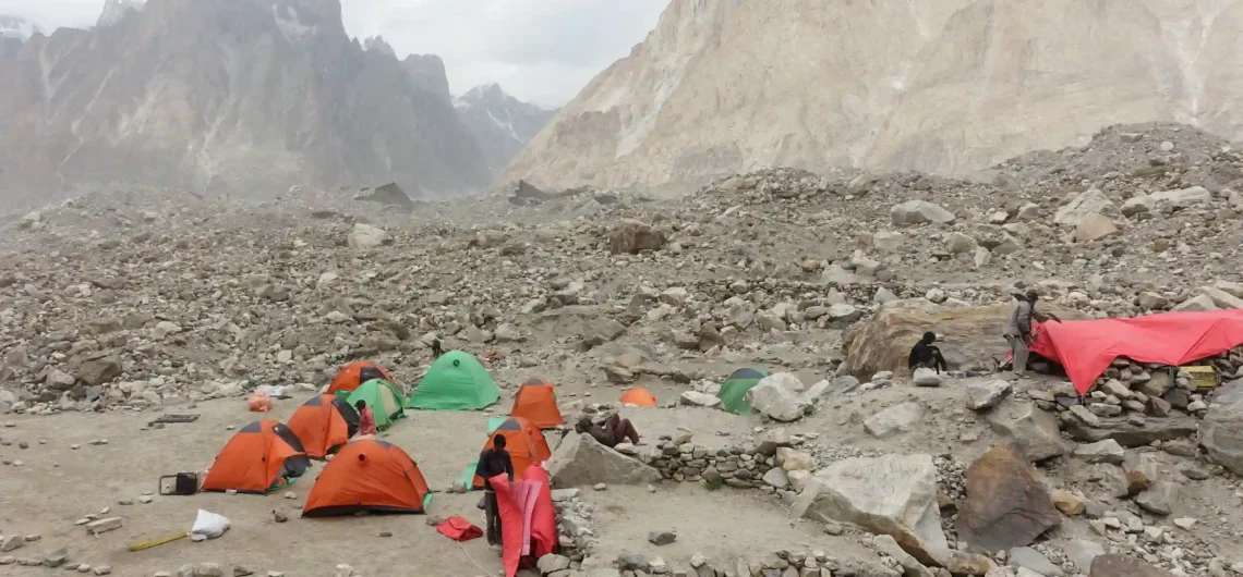
There is a place in northern Pakistan where four of the world’s fourteen 8,000-metre peaks rise from the same glacial bowl, where a river of ice stretches 62 kilometres through the most concentrated collection of high mountains on Earth, and where even the world’s most seasoned alpinists fall silent. That place is the Baltoro Glacier — and the trek along its length is, by almost any measure, the most dramatic mountain journey a human being can make on foot.
The Baltoro Glacier sits deep within the Karakoram range in Gilgit-Baltistan, Pakistan. At 62 kilometres long, it ranks among the longest non-polar glaciers in the world, and its upper basin — a glacial amphitheatre called Concordia — is where the Baltoro, Godwin-Austen, and Vigne glaciers converge beneath K2, Broad Peak, Gasherbrum I, and Gasherbrum II simultaneously. Photographer Galen Rowell called it “the Throne Room of the Mountain Gods,” and not a single trekker who has stood there has ever disagreed.
This is not a trek for the casual hiker. It is, however, a trek for anyone who has ever looked at a mountain and felt something stir. This complete Baltoro Glacier trek guide will tell you everything you need to know before you go.
Trek Overview
| Detail | Information |
|---|---|
| Trek Type | High-altitude glacier trekking |
| Total Distance | ~160 km round trip |
| Duration | 18–25 days |
| Difficulty | Expert / Strenuous |
| Maximum Elevation | 5,150m (K2 Base Camp) / 4,690m (Concordia) |
| Starting Point | Askole village, Gilgit-Baltistan |
| Permits Required | Yes — via Pakistan Alpine Club, Skardu |
| Licensed Guide | Mandatory |
| Best Season | June – early September |
| Nearest City | Skardu (fly or drive from Islamabad) |
Route Breakdown: Campsite by Campsite
The Baltoro Glacier trek follows a single corridor from Askole into the heart of the Karakoram. There are no alternate routes — the glacier and the valley walls dictate the path. What changes is the scale: with every passing day and every additional kilometre of altitude, the mountains grow larger, and the world you left behind feels further away.
Stage 1 — Askole (3,000m): Where the World Ends
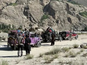
Askole is the last inhabited village before the wilderness, a small settlement of wood and mud-brick houses in the Shigar Valley surrounded by corn fields, potato terraces, and apricot groves. It takes roughly 7–8 hours by jeep from Skardu along a deteriorating track that follows the Braldu River, and arriving here already feels like an achievement.
This is where your porters and final expedition supplies are organised. Spend time in Askole: eat well, sleep fully, and check every piece of kit before the valley swallows you. The village sits at 3,000 metres, and from the moment you leave it on foot, there is no road, no reliable phone signal, and no quick way out.
The first day’s walk crosses the tongue of the Biafo Glacier, a churning mass of ice that looks like a great frozen storm, before continuing toward the Jhola or Korofong campsites along the Braldu River through increasingly barren canyon walls.
Key facts:
- Drive time from Skardu: 7–8 hours by jeep
- Elevation: 3,000m
- Last point of resupply; no shops beyond here
- Permits and porter logistics finalised here
Stage 2 — Paiju (3,400m): The Green Oasis
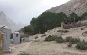
After two days of walking along rocky riverbanks and canyon trails, Paiju Camp arrives like a reward. Nestled beneath Paiju Peak (6,610m) beside freshwater streams, it is a green and relatively sheltered campsite, the last meaningful vegetation you will see until the return journey.
The name “Paiju” comes from the Balti word for salt, referring to rock salt deposits at the base of Paiju Peak. Local folklore holds that the snow capping the peak is not snow but an enormous salt deposit dripping slowly to the valley floor.
From Paiju, you get your first views of the Baltoro Glacier, a river of grey-brown ice filling the valley ahead, larger and more chaotic than most people expect. Trekkers typically spend a rest day here for acclimatisation. Use it wisely: the glacier section begins the following morning and demands full physical readiness.
Key facts:
- Distance from Askole: ~40km (2 days walking)
- Elevation: 3,400m
- Last grassy campsite before the glacier
- Rest day standard here; crucial for acclimatisation
- First views of the Baltoro Glacier and Cathedral Towers
Stage 3 — Urdukas (4,050m): The Balcony Above the Ice
Leaving Paiju, you step onto the Baltoro Glacier. This is the moment the trek transforms. The moraine, a chaotic river of boulders, gravel, and ice that the glacier carries on its back, demands constant attention underfoot, but your eyes refuse to cooperate because what surrounds you is staggering.
The Trango Towers rise to the north in an eruption of sheer granite that represents the world’s greatest concentration of vertical rock. Cathedral Towers, Uli Biaho, and the Great Trango Tower, its 4,396-metre vertical relief making it one of the tallest cliff faces on Earth, line the northern horizon as you advance up the glacier.
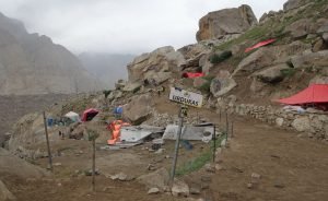
Urdukas Camp sits on a grassy ledge above the glacier at 4,050m, the last dry campsite on the route. It offers an unobstructed balcony view across the entire Baltoro corridor that many trekkers describe as the single most beautiful campsite they have ever occupied. Gasherbrum IV (7,925m) appears for the first time here, its diamond-shaped summit cutting the eastern sky.
Key facts:
- Elevation: 4,050m
- Last grassy campsite of the entire route
- Views: Trango Towers, Cathedral Towers, Gasherbrum IV
- Short trekking day; rest here before the push deeper into the glacier
Stage 4 — Goro II (4,300m): Deep into the Ice
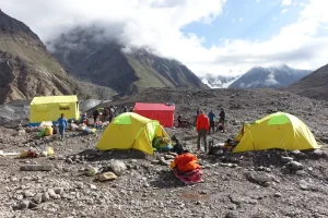
Beyond Urdukas, the glacier becomes the only terrain. There is no trail in the conventional sense — just moraine, ice, and the accumulated knowledge of your guide reading a landscape that shifts and reforms each season. The sky narrows between enormous walls of rock and ice. The cold becomes a constant companion, not a temporary condition.
Goro II sits at 4,300m near the centre of the Baltoro Glacier itself — a stark, windswept campsite on the lateral moraine where night temperatures drop severely even in midsummer. It is not a comfortable place. It is, however, an extraordinary one.
From Goro II, the full western face of Masherbrum (7,821m) appears on the southern horizon with a kind of dark authority. Broad Peak’s long ridge emerges ahead, and for the first time, experienced trekkers begin to sense that Concordia is close.
Key facts:
- Elevation: 4,300m
- Located on the glacier itself, cold and very exposed
- Views: Masherbrum, Gasherbrum IV, Broad Peak ridge beginning to appear
- Night temperatures well below freezing, even in July; full insulation is essential
Stage 5 — Concordia (4,690m): The Throne Room
Nothing prepares you for Concordia. You can read about it, study photographs, watch expedition documentaries — and still, when you round the final bend, and K2 rises before you in its full, black, pyramidal enormity, the response is entirely physical. Trekkers report their legs stopping of their own accord. Some cry. Most simply stand in silence for a very long time.
Concordia is where the Baltoro, Godwin-Austen, and Vigne glaciers converge. From this point, within a 21-kilometre radius, you can see K2 (8,611m), Broad Peak (8,051m), Gasherbrum I (8,080m), Gasherbrum II (8,035m), and Chogolisa, an assembly of giants with no equivalent anywhere else on the planet.
K2 itself does not reveal itself gradually. It appears all at once: a black triangle of rock and ice so steep it seems to violate the normal geometry of mountains. Reinhold Messner called it “the Mountain of Mountains.” Standing beneath it at Concordia, the phrase feels not like hyperbole but like a plain statement of fact.
Trekkers who choose to extend the adventure continue 4–5 kilometres up the Godwin-Austen Glacier to K2 Base Camp at 5,150m — a demanding but deeply rewarding half-day push.
Key facts:
- Elevation: 4,690m (Concordia) / 5,150m (K2 Base Camp)
- Peaks visible simultaneously: K2, Broad Peak, Gasherbrum I & II, Chogolisa
- Spend at least 2 nights here: one for recovery, one for sunrise and exploration
- Return to Concordia to sleep; K2 Base Camp is too high for safe overnight stays
Difficulty & Altitude
The Baltoro Glacier trek earns its expert classification not through a single terrifying moment but through the sustained physical and mental demands of three weeks in remote, high-altitude terrain.
Physical demands
The glacier moraine requires hours of boulder-hopping, balance, and concentration every single day. Expect 6–9 hours of walking on most trekking days, often on unstable surfaces with significant elevation change. There are no flat, well-marked paths once you step onto the Baltoro.
Altitude
Concordia sits at 4,690m and K2 Base Camp at 5,150m. At these elevations, altitude sickness is a genuine risk for even physically fit individuals. The itinerary builds acclimatisation days at Paiju (3,400m) and Urdukas (4,050m) for this reason. Never ascend while experiencing severe symptoms.
Remoteness
This is a restricted zone. There are no rescue vehicles, no nearby hospitals, and helicopter evacuations are expensive, weather-dependent, and not guaranteed. High-altitude emergency evacuation insurance is not optional — it is essential.
Minimum preparation
- At least 3 months of consistent cardio and strength training before departure
- Prior experience trekking at an altitude above 4,000m is strongly recommended
- 2–3 acclimatisation days in Skardu (2,500m) before beginning the trek
Best Time to Visit
June: Early season, quieter trails, spectacular light. River crossings run high from snowmelt, and snow may cover moraine sections. Preferred by experienced trekkers who value solitude.
July and August: Peak season. Most stable weather window, warmer temperatures, and best overall conditions on the glacier. Wildflowers appear around Paiju. Longest daylight hours for comfortable trekking schedules.
Early September: The season winds down. Temperatures drop sharply above 4,000m, but the first two weeks often bring outstanding stable weather with dramatically fewer trekkers on the route.
Avoid October through May: Heavy snowfall, dangerous river crossings, and extreme cold make the entire route inaccessible and unsafe.
Packing List
Packing correctly for the Baltoro is not about comfort — it is about safety. The glacier strips away every margin for error.
Clothing
- Waterproof, insulated trekking boots (broken in thoroughly before departure)
- 2–3 thermal base layers (wool or synthetic — no cotton)
- Fleece mid-layer and heavyweight down jacket rated to at least -15°C
- Waterproof shell jacket and waterproof trousers
- Warm hat, balaclava, trekking gloves, and insulated outer gloves
- Glacier sunglasses with UV protection — mandatory; reflected glacier light is severe
- Gaiters for moraine and snow sections
Equipment
- 4-season sleeping bag rated to -20°C minimum
- Trekking poles — mandatory on moraine terrain
- Headlamp with spare batteries
- Personal first-aid kit including blister care, ibuprofen, and rehydration salts
- Altitude medication (Diamox / Acetazolamide) — consult your doctor beforehand
- Portable water filter or purification tablets
- High-SPF sunscreen and strong lip balm
- Power bank — no charging infrastructure anywhere on the route
- Trekking pack 55–70 litres with dry bags for electronics
Documents & Permits
- Valid passport and copies
- Baltoro/K2 Restricted Zone permit (arranged through a registered Pakistani tour operator)
- Travel insurance documentation — emergency evacuation cover mandatory
- Emergency contact list in printed form
Leave behind: Anything non-essential. Porters carry cooking equipment, tents, and communal food. Your personal pack should be kept as light as possible — the glacier will make you grateful for every kilogram you left at home.
Conclusion
There are treks that are beautiful, and then there is the Baltoro. The distinction matters. Beauty is a gentle, pleasant thing — and the Baltoro is not gentle. It is enormous, austere, occasionally brutal, and entirely indifferent to your comfort or your schedule. It will make you feel small in ways that no photograph or description can fully convey.
The Baltoro Glacier trek is not for everyone. But for those it calls, it calls loudly, and usually more than once. Planning your Baltoro trek? Explore our complete Pakistan permit guide, acclimatisation advice, and recommended tour operators to get started.